Mixed Reality: A Pioneering User Experience for Field Operators
Video games and the movies have been the entry point for the public to experience AR/VR (Augmented Reality/Virtual Reality). Over the past ten years or so the technology has established a role in industry applications, most notably design and construction and urban master planning. One of the primary uses are around stakeholder engagements, communicating scheme proposals and project plans.
A fast-growing application is leveraging AR/VR for managing real time office and ground team operations. For instance, in the mapping of underground utilities for planning, construction and maintenance. AR/VR has complemented or replaced traditional approaches based on paper and digital CAD/GIS plans that required labour-intensive surveys, accuracy issues and risk of accidents to personnel or other utilities. With the advent of AR/VR people can undertake this type of work from above ground, with access to up-to-date and live information that have improved efficiency, safety and cost.
Wearing the headset to understand location of asset.
Credits: Energie 360, Martin Seger and V-Labs SA
There are three key elements in any AR/VR implementation. The first is an application that can provide real time access to current information, second is data in 2D or 3D and third a headset (hardware) with sufficient location accuracy, clarity and wearability.
There are a variety of companies out there providing these services however we were interested by V-Labs, a Swiss based start-up, who have developed a rather unique solution with user experience at the forefront. They have created a headset that has integrated, real time GPS (GNSS/RTK), with driftless data positioning and hands-free mobility, which means there is no additional cost needed for other GPS equipment, provides consistent cm accuracy data wherever you walk and with both hands available improves safety and working efficiency.
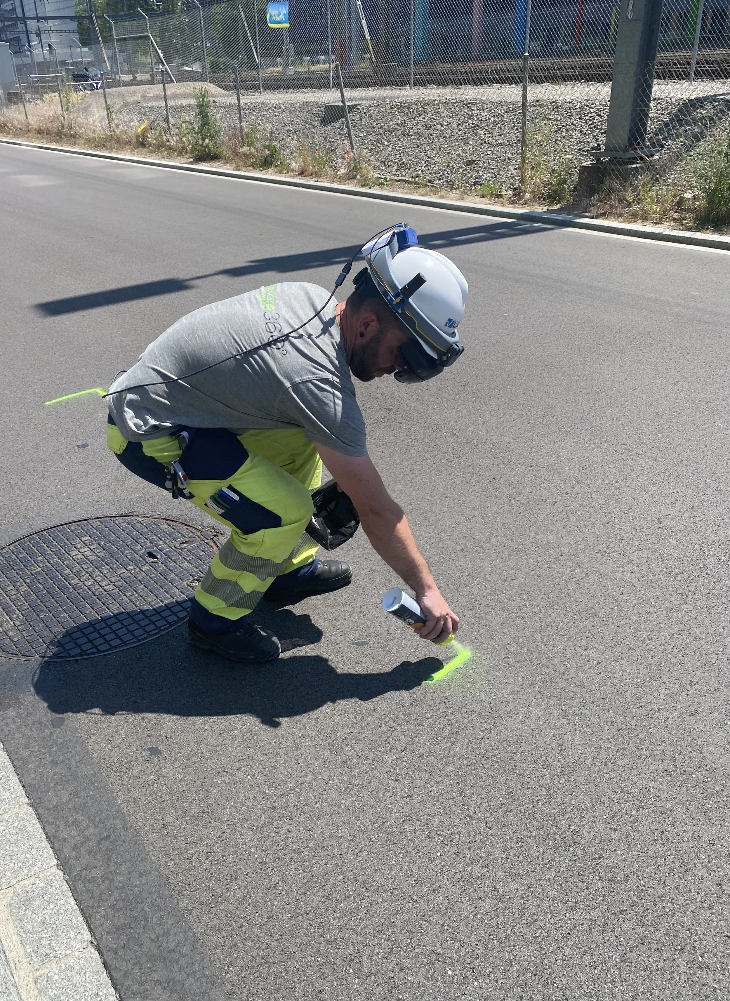
They recently implemented a pilot project with Energie 360 a company renovating the gas pipes in Zurich, Switzerland. Working in pairs, one with a mobile tablet to monitor and control, the other wearing the AR headset and glasses, the glass wearer can start the application, visualise the pipes underground and obtain cm satellite accuracy using just his finger and once confirmed, mark up the lines for the engineers with the usual spray paint.
Asset found and sprayed up on the ground
Credits: Energie 360, Martin Seger and V-Labs SA
It's key to point out that Energie 360 needed an accuracy of 10cm or less (clients often have accuracy requirements see GNSS for Rail blog) so the ability to provide that using GPS in the headset was fundamental. This of course relies on the underlying data and the accuracy of 2D information that has been captured using traditional survey and GIS. Amazed by the results, Energie 360 are hoping to improve this in the future with a 3D version, built on a BIM model that includes depth information too that is even more important when breaking ground and understanding the relationship with other nearby assets.
You can visit here for the full article provided by our friends at V-Labs. The future is exciting for this technology – there is so much potential in design and construction, operations and maintenance that can increase productivity (reducing paper, usable by site workers), mitigate costly utility impacts/safety risks and save time and money for project management and asset management.

